-40%
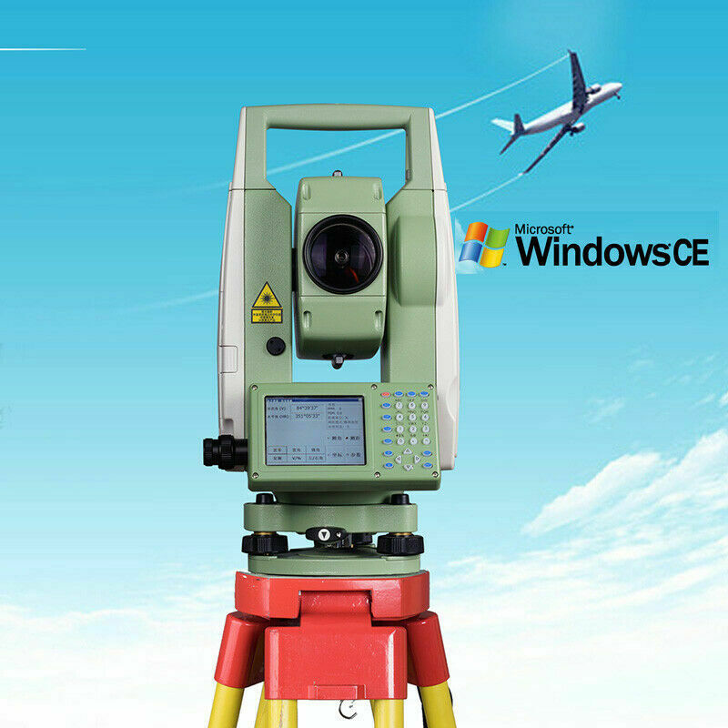
NEW SANDING STS 772R10L Windows CE operating system laser total station
$ 1504.8
- Description
- Size Guide
Description
STS-772 series is a new generation total station with Windows CE operating system independently developed by Sanding Optoelectronics.
Windows CE 6.0 operating system, computerized operation on the total station.
The full touch screen graphical interface is intuitive and convenient; the 3.5-inch large LCD display has a backlight panel for easy operation under low light conditions. High-brightness LCD screen, clearly visible under strong light.
The latest Bluetooth connection module; intelligent wifi connection; 1000 meters long measurement range without prism; powerful voice broadcast system.
Sanding STS-770 series total station truly realizes the computerization, automation, informationization and networking of the total station.
Product Highlights:
1. Window CE 6.0 Chinese operating system
The computerized operation is realized on the total station, which is specially designed for handheld computers and embedded devices. Users can write measurement programs as needed to improve work efficiency.
2. Built-in Bluetooth 4.0
Provide a durable wireless connection with the lowest energy consumption, and no longer have to worry about carrying data. The longest transmission distance can reach 15 meters.
3. Unlimited network function (Wifi)
Wireless network communication technology, surfing the Internet in a shared way, intelligent management improves mobile performance, and realizes online traffic sending and receiving.
4. Touch color screen
No need to use the keyboard, you can directly click on the screen to operate. Under the high-intensity sun, the screen still displays clearly.
Technical characteristics:
1. Absolute coding angle measurement
No initialization is required to start up, which can avoid data loss due to power-down shutdown during measurement. Improve the accuracy and stability of angle measurement.
2. Laser distance measurement without prism
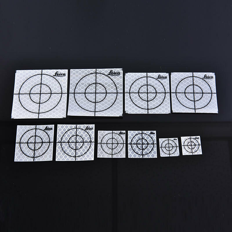
Point emitting surface receiving, longer measurement range; fast speed: precise measurement 0.3 seconds, tracking 0.1 seconds; long measurement range: prism-free measurement range 1000m, reflector sheet 1000m, single prism can be 5000m; high accuracy: 2+2 ppm range measurement Accuracy, 2 "angle measurement accuracy.
3. Biaxial liquid photoelectric electronic compensation
Internationally advanced dual-axis compensation technology, horizontal and vertical compensation at the same time, automatically eliminate errors. Graphical electronic bubbles are clear at a glance.
4. IP55 grade waterproof and dustproof design
The battery adopts a built-in design, and the key parts such as the horizontal and vertical axis, the panel, and the telescope focusing are protected by waterproof rubber rings to ensure that it can adapt to various harsh environments.
5. Convenient data communication
Equipped with SD card and USB data import and export methods, users can freely choose. The SD card can be expanded up to 32GB; USB uses the factory-standard OTG data cable, which can be directly connected to a U disk.
6. Laser pointing
With laser pointing function, it is more convenient to find the target. It can also be used as a laser pointing instrument.
7. Point to point under laser
The visible laser beam can directly aim at the center point, eliminating the tedious operation of adjusting the eyepiece and improving work efficiency.
8. Automatic correction of temperature and pressure
Freescale temperature and pressure sensor, one-key access to meteorological parameters.
9. The screw pitch is changed from 0.35MM to 0.25MM
The fine-tuning amplitude is encrypted, and the eyepiece alignment is more accurate.
10. Big screen, big buttons
The 3.5-inch LCD color screen is convenient for data entry and viewing.
11. The user can customize the measurement program
Based on different industries, the measurement methods and procedures of different units are very different. Sanding STS-770 series win CE total station provides users with a popular Windows platform, and users can write measurement procedures according to work needs. Since then, surveying and mapping is no longer picky about the industry.
Based on win CE platform
Wizard surveying software series integration
Users can customize the measurement program
Based on different industries, the measurement methods and procedures of different units are very different. Sanding STS-770 series Win CE total station provides users with a popular windows platform, and users can write measurement procedures according to work needs. Since then, surveying and mapping is no longer picky about the industry.
Control measurement:
Strip terrain and hidden areas, such as line control survey and urban control survey, use the basic measurement function of the total station-traverse measurement. The layout of the traverse network and the corner network is very flexible, convenient for observation and high precision. Used in conjunction with GNSS products (handhelds, RTK), the form of network layout is more flexible, observation is more convenient, and accuracy is more reliable. Plane and elevation control can be carried out at the same time, using a total station for trigonometric elevation measurement can completely replace fourth-level leveling.
Topography:
The program measurement function of the total station is used for three-dimensional coordinate measurement, side measurement, rear intersection, etc. It is not only easy to operate, but also fast and accurate. It can simultaneously perform control measurement and measurement of broken parts. Through the transmission equipment, the total station can be connected with the computer and the plotter to form an integrated surveying and mapping system of internal and external industries, thereby greatly improving the quality and efficiency of topographic mapping.
Engineering stakeout:
Using the total station lofting measurement function can quickly and accurately measure the locations of the designed buildings, roads, pipelines and other facilities to the construction site according to the requirements of the drawings, as the basis for construction; especially some complex shapes and requirements Tall and large-scale buildings (structures), etc.
Deformation Monitoring:
In the deformation observation of buildings and the dynamic monitoring of geological disasters, the coordinate measurement function of the total station is used to monitor the three-dimensional coordinates of the deformed parts in real time, which can grasp the deformation law in time and ensure the safety of the structure.
